Summer is drawing to an end, I guess. It’s been kind of a weird summer for me. With Charlie passing away in the spring, I have been doing anything and everything that gets me out of the house and just busy. It’s been just over 4 months, but still, if I see pictures of Charlie, or think about him, I still get all emotional.
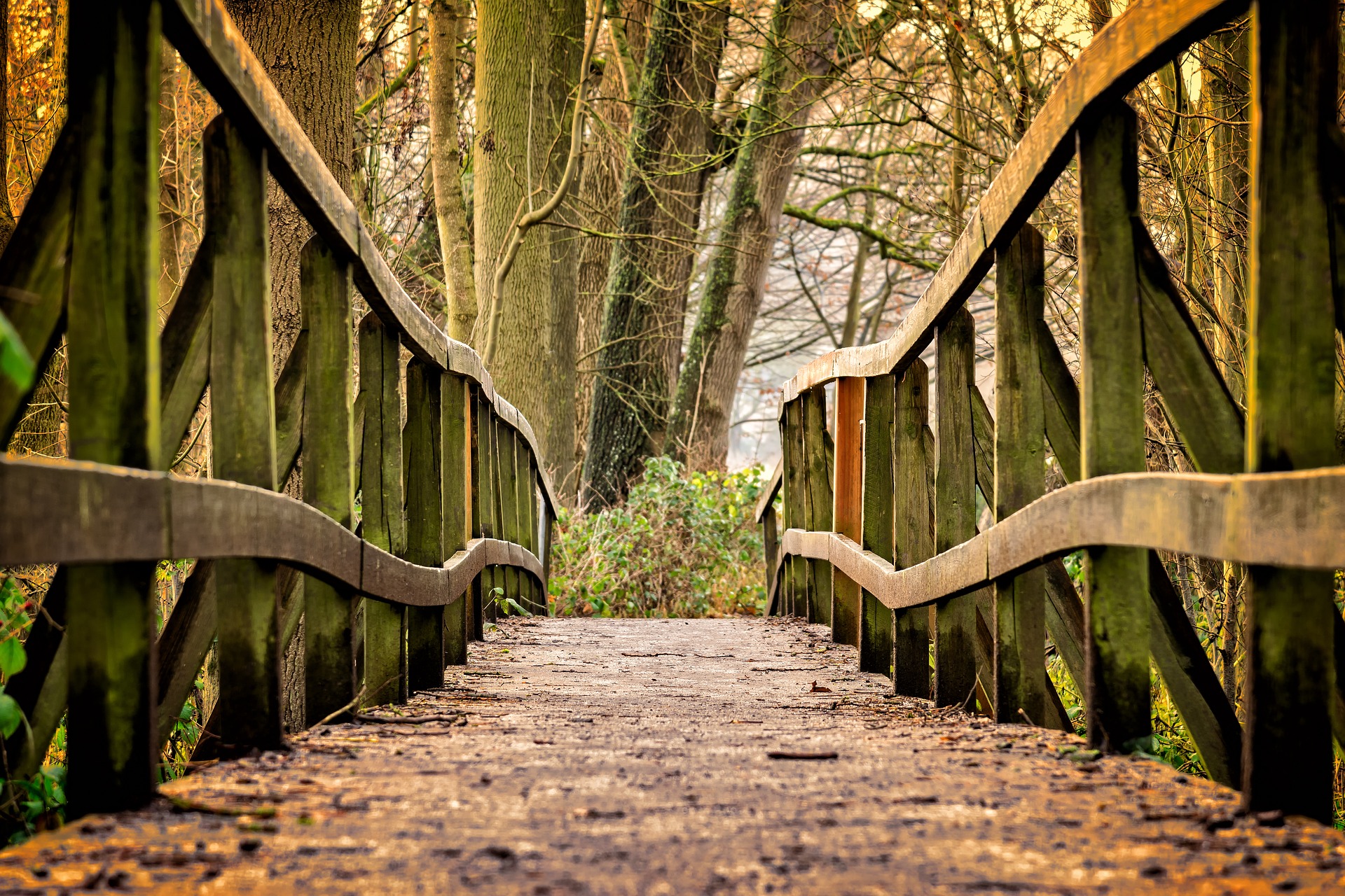
Pretty much every weekend this summer I have been outside hiking. Me. Hiking. Who knew? Lately, I have thought about how I should have documented all the places I have been so far, whether I liked them or not, etc. Shame I didn’t think of that at the beginning. So, I’m writing this post to summarize everywhere I’ve hiked so far. There were no real criteria to the trails I have so far chosen to do other than I want them to be 2 miles or longer. What I told a friend was anything between 2-6 miles. I think that is a good enough goal for my first summer ever hiking.
Queeny Park – Hawk Ridge Trail – 4.5 miles
My first ever “real” hike if there is such a thing was at Queeny Park over in Missouri on a trail called the Hawk Ridge Trail. I met up with the husband of a former coworker and we walked the trail after work one day. It was a good walk, took about 1.5 hours. There was a good mix of paved and unpaved surfaces. It was good that my first hike was with a friend. I don’t know if I would have necessarily done it if I didn’t have someone there to talk to. I might have stopped halfway or something. The trail started and ended with a big hill. Going counter-clockwise, you start by going down a paved hill. It’s mostly flat with a little up and down, until the Northeastern corner of the trail, where there is a big hill going up. This was the only spot I had to rest for a minute, and it was really just because my new hiking shoes were hurting my ankles on such a steep incline. Still, it was a good walk.
Cahokia Mounds – 3.5 miles
This is the first solo hike I did. I had been to Cahokia Mounds a couple of times as a kid to walk up Monks Mound. I never knew they had trails out there. The whole site is a swamp, which until I was on the trail, I didn’t know. This is important because it made me realize why the Indians built the mounds. Their lands kept flooding. That makes so much sense. The trail starts from the visitors center as a paved trail. It wanders through a bunch of smaller mounds, and within the first mile or so it turns from paved to gravel, to dirt, and then to grass. I really enjoyed the mix of forest and prairie that this trail offered. I will say to anyone that is interested in walking this one, go on a cool day. Even though I started early, the parts in the sun were killer. I can’t imagine going in August. In fact, during the prairie part, I was so hot, my plan to hike up to the top of the mound, I decided against. I was just too hot. I saw so much wildlife on this trail. I haven’t seen that much, actually, on any trail since. I saw a grand total of 15 deer, mostly during the prairie part. Most of these deer scared the crap out of me. They like to bed down in the tall prairie grasses, and on several instances, they were bedded just a few feet from the trail. If you got too close, they would jump straight up and run away. When that happened, they would make this weird sound. I assume it is just a yelp or something, but it sounded like a kazoo to me. It was both surprising and hilarious.
During one part of the trail, I was really worried. The trail ran between a hill covered in tall grasses and a wooded area. At the top of the hill, sticking up above the grasses, all I could see were buck antlers. Easily 6 points on each side. I was worried that if that got spooked, it would beeline for the woods, and me walking there wouldn’t be so good. The trailed turned to the right though and started up the hill. This is where I was getting really concerned, it crested the hill, and turned a corner and there may be 150 feet ahead on the trail was the buck, a doe, and the smallest baby deer I’ve ever seen. I expect it was brand new because I didn’t know they could be that small. But the problem, of course, is, how to get past this little family without getting murdered? In my pocket, I had a tin of Altoids smalls sugar-free mints. I really like these mints because they are sugar-free. I don’t have to worry about eating to many and them pushing me out of ketosis. I pulled the tin out of my pocket and started shaking it. I would shake it every few seconds as I stood there on the trail. Eventually, the deer bounded off. I was relieved, understandably, but I kept the mints out and continued to shake them every few yards. It came in good handy, there were several other deer bedded down near the trail and they heard the shaking mints and ran off before I got too close.
I am looking at my review on Alltrails (linked above) and I can’t believe that was only a month ago. Seems like it was a lot longer. The Alltrails app is kind of neat, you can search for different trails, and then record them. Unfortunately, the moment you lose cell reception, it stops recording. By some grace of god, it recorded all of the Cahokia Mounds trail. Not sure how that happened.
Lone Elk State Park – White Buffalo Trail Loop – 3 miles
This trail is the only “moderate” trail I have done. I didn’t know what the difference was between easy and moderate other than one is harder. Well, the difference is elevation. White Buffalo Trail had a lot of up and down. I really wanted to do this one because it was in Lone Elk Park, which is known for its herd of elk. I didn’t see any elk. I found out after the hike, that to see the elk, you have to go into a different part of the park. The loop that I did was around
the lake, where the elk can’t get to.
At work, around this time, I planned and started running a step challenge. I set up some weekend activities for anyone interested, and I made this hike the first activity. Only one person and her husband showed up for the activity. Because of all the up and down, this hike took 2 hours. I was so exhausted afterward, I can’t even describe it. Then I had to drive an hour back home. It was kind of brutal.
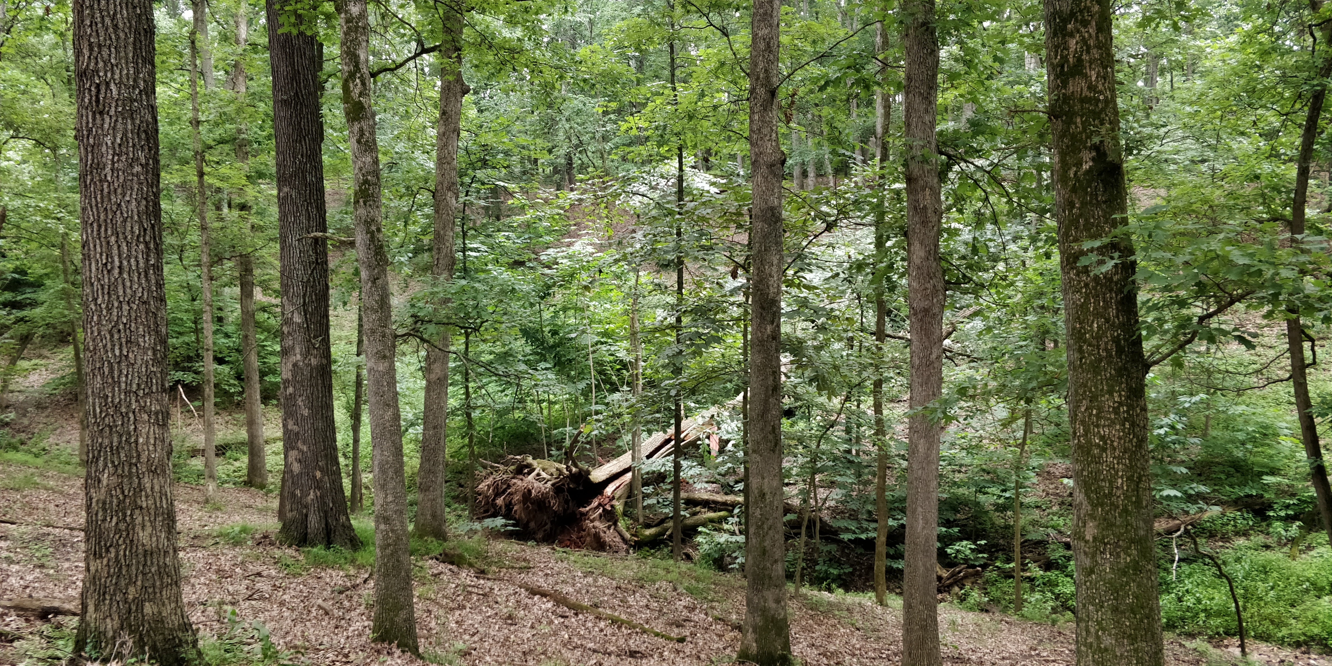
The only eventful thing on this trail was a huge downed tree. The tree was easily 5 feet in diameter, and based on the green leaves still on it, had recently fallen in a storm. The tree fell right onto the trail so I had to climb up a pretty steep, very muddy hill to go around it. Luckily, I had trekking poles with me. I don’t know if I would have made it without them.
The alltrails app got about 75% of this trail before it crashed out on me.
Jefferson Barracks Park – Dennis Schick Trail – 2.5 miles
This is just a park. Like a standard community park. The whole trail is paved. I went on a recommendation of a former coworker. There was some wildlife, but not a lot. The hike took about an hour. It was hot, and by the end, I had drunk too much water and so I had to pee. If I hadn’t, I would have gone around a 2nd time. What is neat about this trail, is it is right next to the military training base. You can see the cadets out there doing whatever it is cadets do. There is also a tank and an old radar out there. Had it been cooler, and had I a real camera with me, I would have liked to get closer to those and take better pictures.
Alltrails got 75% of this trail also before it stopped recording. It would be nice if it could have recorded the whole thing so I could post it here for the zero people that read this blog to see.
Dunbar Cave State Park – Full Loop – 2.5-3.5 miles
I don’t know how long this trail is/was. Alltrails only has the lower recovery loop as a trail, and that part is just under 2 miles. There is a northern section that you can see on their website that adds additional distance to the trail. This was a very nice trail. The lower part is all in the woods. There’s a little bit of up and down, but not much. The northern section is all prairie, and the grass is very tall and overgrows the trail a little. I was in town that weekend for a party at my cousin’s house and we tackled the trail one morning. It took about 1.5 hours. It was very enjoyable, and I wouldn’t mind doing it again next time I’m in Tennessee.
The alltrails app, which I gave up on after this hike, got all of .4 miles before it crashed. Lately, I have been using something called MapMyHike, which seems to do a much better job, and doesn’t crap out.
Stony Creek Metropark
Recently, I took a trip up to visit my brother and his family. They live about an hour north of Detroit. I took 2 hikes while I was there, both at Stony Creek.
West Branch Loop – 3.38/4.7 miles
The first was the West Branch Loop. Well, most of the West Branch Loop. I didn’t realize, actually, until right this moment, that we somehow skipped about a mile of the loop. Not sure how that happened. This was an excellent hike. My brother and I finished it in an hour and 20 minutes. The surface was mostly rock, though there were a few parts that wandered through some grass. There were lots of bugs, but that’s to be expected next to a lake. I wish I had taken a picture, but there was one spot where you came around a corner, and instead of the usual hardwood trees, there was a long row of pines. It was very idyllic. On a side trail, through the pines, they were set up for a wedding. It was neat, though I have no idea how the wedding people would get there and not get dirty.
Stony Park Trail – 3.45/6 miles
There is a paved trail that circles Stony Creek Lake. The trail is a 6-mile loop. I did 3.45 miles, so close to 2 miles of the loop before turning around. My brother and his family went to play on the massive playground they have there. As much fun as it is to sit in the sun and watch little kids run amuck, I grabbed my gear and wandered around. The first .45 or so of the walk, I did something called the fitness trail. It’s not on any of the maps that I can find, but it was nice and through the woods. After that, I was pretty much in the sun all the way down to the dam and back. It was a good walk. I told my brother, that if it hadn’t been so hot, I would have liked to have gone all the way around.
So…that’s it. It’s August 8th, and so far this summer I have hiked a little over 20 miles this summer. There are a few weeks of summer left, and I hope to tackle a few more trails. Maybe I can get to 30 miles? That sounds like a good goal for this year. Next year, I’ll plan on 50.